
Dalton Neighbors Across One Block
No public source gives a complete roll of Dalton neighbors. The Whitfield parcel viewer supplies the block's geometry, qPublic adds the owner and mailing address for each parcel, and the state voter-list channel may add registered names at an address. Historic directories can reconstruct an earlier block. Each source has a different meaning, so the first task is choosing the source that fits the question.
| Source | What It Shows About a Block | Access |
|---|---|---|
| Whitfield Esri and legacy GIS | Parcel outlines, touching lots and parcel IDs | Free map and click browsing |
| Whitfield qPublic | Owner, mailing address, situs and legal description | Free individual parcel records |
| Georgia public voter list | Registered names and addresses, less protected records | Ordered from Secretary of State under current rules |
| Plat and deed | Subdivision lots, blocks, easements and title | GIS plat search and Superior Court Clerk |
| Dalton directory street section | Historic sequence of printed occupants | DLG and Dalton library |
| Public civic contacts | Officers and a way to reach an organization | Published contact or direct request |
An assessor result proves who is listed for tax ownership, not who sleeps at the address. The mailing address may belong to an owner elsewhere. A voter file is a registration snapshot, not a census, and a directory can be incomplete. Keep “owner,” “registered voter” and “printed occupant” as separate labels. That small habit prevents the most common false claim in a neighbor lookup.
Map Dalton Neighbors Parcel by Parcel
The Whitfield Esri parcel viewer turns one address into a defensible set of adjacent lots. Locate the exact parcel, zoom until its boundary is clear, and record its parcel ID. Then click only the parcels that touch it. The map provides context, while linked assessment records provide the indexed ownership details.
- Search the exact Dalton address and confirm the selected feature by parcel number, not just its map label.
- Click each touching parcel. Record the parcel ID before opening its assessment detail.
- Copy owner, mailing address, situs and legal description separately. Never treat a matching mail and situs address as proof of every occupant.
- Check the subdivision plat when a common area, split lot or multiunit parcel makes adjacency unclear.
- Date the results and stop at the chosen block boundary. A whole-street search is a different task.
The legacy Whitfield GIS gateway also offers general parcel search, parcel-number search, comparative sales and scanned subdivision plats. Popups must be enabled. GIS is general information, not a legal survey, and its functions can change. For the full named-road chain, use the Dalton street directory workflow instead.
Note: Two touching parcels with the same mailing owner show common title, not two households or a family link.
Read Dalton Neighbor Parcel Cards
Open the Whitfield qPublic search for each parcel ID. Its owner-name, location-address and parcel-number fields provide several ways to confirm the right record. The card may show Realkey, tax district, neighborhood, subdivision, lot, acreage, class, value fields, a property-record-card link and a GIS link.
The most useful distinction is between Owner Address and Parcel Address. The first is for tax correspondence. The second, also called the situs, is where the land lies. An out-of-town owner address can suggest non-occupancy but does not tell who lives in the Dalton building. Photos and sketches show exterior property facts only.
- Parcel
- A separately identified unit of land for assessment.
- Situs
- The physical parcel location, apart from the owner's mail address.
- Plat
- A recorded drawing of lots, blocks, easements and subdivision lines.
- Realkey
- A Whitfield internal identifier displayed in addition to the formatted parcel number.
Georgia Voter Data Near Dalton
Georgia My Voter Page and the public voter list are not the same thing. My Voter Page authenticates one voter using personal fields and returns that person's registration, polling and district information. It is not meant for browsing a block. Names and addresses in public voter files are obtained through the Secretary of State's separate list-order channel, subject to current product, fee and use rules.
Match voter addresses to parcel situs with care. Several voters can share one address. Renters can appear where the tax owner does not, while minors, nonvoters and protected people will be missing. Participation history can show elections in which a voter took part, never the selections made on a ballot.
The Georgia VoteSafe program shields residence addresses for qualifying registered voters. Any public block table must respect those omissions and all redactions. Full birth dates, Social Security numbers and state identification numbers are not normal public neighbor-directory fields.
Dalton Neighbor Voter Self-Lookup
The official Georgia My Voter Page image below shows the self-lookup route that a registered Dalton voter can use for personal registration and district details.
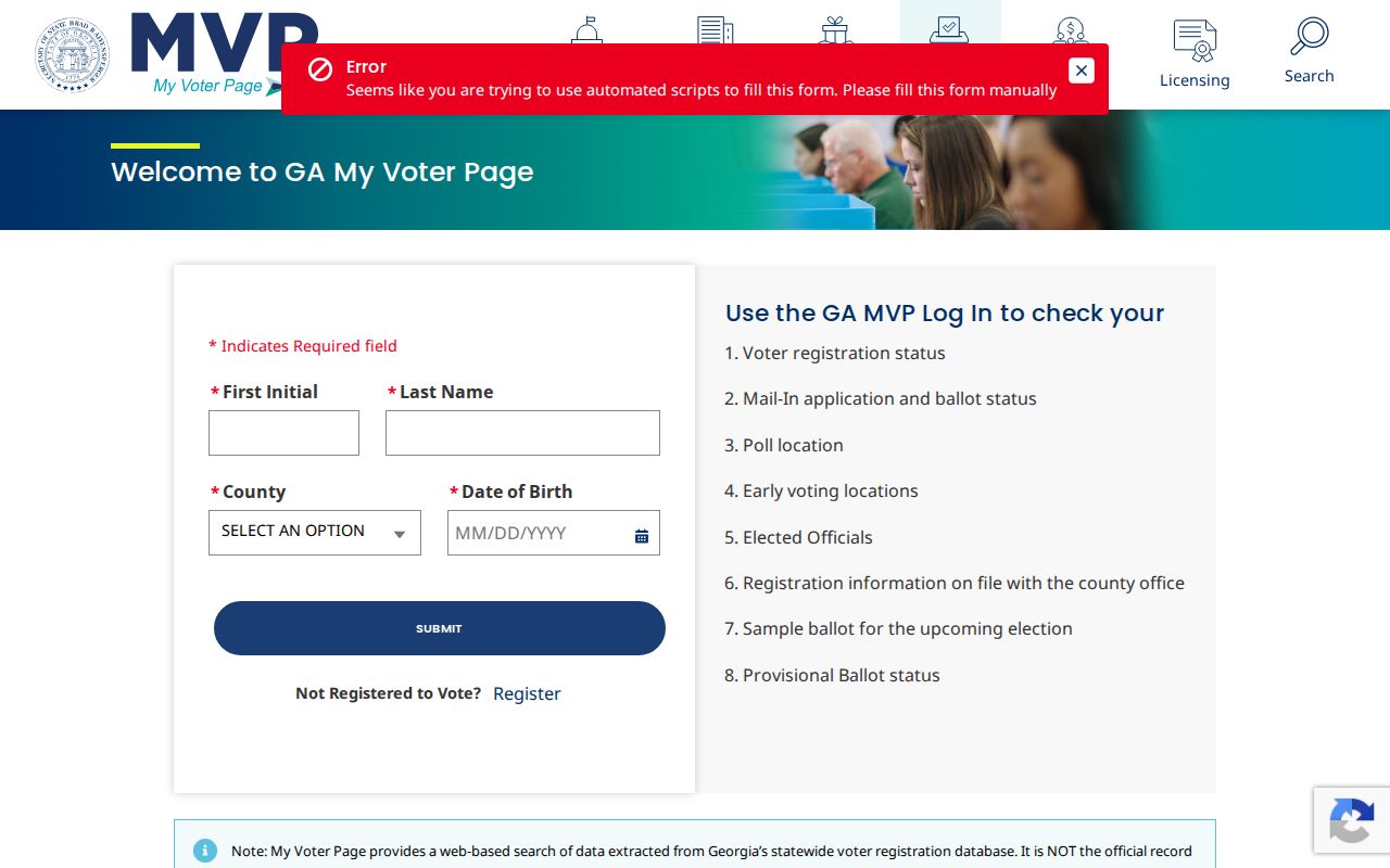
The authentication screen illustrates why MVP should not be treated as a public block browser. Use the ordered voter-list process for lawful public-list access, and never try to work around protected records.
Plats Define Dalton Block Neighbors
Postal proximity can mislead. A house across a road may sit in another subdivision, and a rear lot may touch the target even when it has a different street name. Search the legacy GIS for the recorded subdivision plat, then read lot and block labels, common areas and easements. A deed or survey controls a legal boundary question; the online map is only a convenient index and view.
Condominiums, split parcels, churches, businesses and common areas need special care. One visible building can cover several taxable units, while one parcel may hold more than one structure. Record the parcel pattern before attaching a name. Parcel geometry is better than ZIP codes for defining immediate Dalton neighbors because postal zones are delivery areas, not block boundaries.
Note: A vacant or common-area parcel may have an owner but no resident to identify.
Dalton Community Contacts, Not Rosters
No authoritative citywide neighborhood-association membership directory was found. Downtown Dalton Development Authority, city boards, chamber groups, named subdivisions, churches and civic organizations can be public contact layers, but they are not lists of households. A published officer or office contact may help with a meeting, street project or local history question. Private member lists should stay private.
| Community layer | Appropriate public use | Boundary |
|---|---|---|
| City boards and authority | Published officers, agendas and public business | Not a resident roster |
| Chamber and business directories | Business and public contact details | Business address is not a home |
| HOA or subdivision contact | Public officer or general contact channel | Membership is generally private |
| Church, club or block watch | Intentionally published public contact | Do not request private membership |
Historical civic material is different. The Dalton library's 1949 Champion Home Town scrapbook includes club rosters, people in photographs and textile-era context. Those archived pages can explain an earlier block while saying nothing about present membership.
Historic Dalton Neighbors by Street
Digitized Dalton directories offer a past block layer. Verified selections span 1940 through 1963, and the 1963 Polk title includes Brookwood, City View and Pine Hills. Where a street section exists, read the addresses in sequence. Then compare a name in the alphabetical section and inspect the scanned page because OCR can misread initials and surnames.
Sanborn maps add block shape and building use at verified points in 1885, 1914 and 1941. They do not identify residents. Pair a map with a directory entry, census household and parcel legal description before claiming that two historical names were neighbors. The 1941 set has 23 sheets, enough to make its index essential.
This method is strongest for local history and genealogy. It can show how a mill-era street changed, but missing directory years and shifting coverage mean absence is never final proof.
Official Dalton Records Versus Tools
Official records and commercial neighbor tools serve different purposes. Official sources identify the custodian, fields and update context. Commercial products may merge old addresses, public records and other data without revealing how a match was made. Treat any commercial result as a lead and return to the parcel, voter or directory source before using a name.
| Choice | Strength | Main limit |
|---|---|---|
| Whitfield parcel and GIS records | Parcel identity, ownership and geometry from the custodian | Ownership is not occupancy |
| Georgia voter-list channel | Registered names and addresses under public rules | Not all residents; protected addresses omitted |
| Historic directory and maps | Period-specific names and block context | Incomplete years and changing geography |
| Commercial neighbor category | May suggest alternate names or prior addresses | Source, age and match quality may be unclear |
Correct an error at the official source first. If commercial exposure persists, use that provider's privacy channel, give only the minimum proof needed, save confirmation and check later for repopulation.
Privacy Limits for Dalton Neighbors
Public records leave real gaps. Parcel rolls omit non-owner household members. Voter lists omit minors, nonvoters and VoteSafe addresses. Driver, utility and delivery data are not public substitutes. Juvenile, adoption, sealed and legally restricted records remain outside a neighbor lookup. Do not infer family ties, ethnicity, legal status or personal relationships from names and proximity.
A block list should identify the record type and date beside every result. Call a parcel owner an owner. Call a voter a registered voter. Suppress a protected or redacted address. If a source cannot support occupancy, leave that claim unstated.
For a specific lawful safety check, use the Georgia Bureau of Investigation registry gateway.
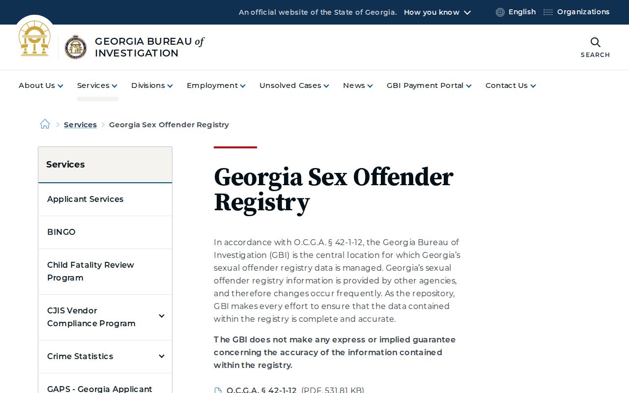
The registry is not a general roster of Dalton neighbors. A result must not be stretched into claims about unrelated people nearby.
Lawful use. Look up Dalton neighbors for civic curiosity, reconnection or personal safety awareness. Never use names or addresses to watch, harass, threaten or intimidate anyone.