
Dalton ZIP Code Coverage
USPS groups three core postal ZIPs under Dalton: 30720, 30721, and 30722. The first two serve street delivery on broad west and east sides. The third routes post-office boxes and is not a residential district. These descriptions are useful orientation, not hard boundary lines. USPS settles the mailing code for one address, while Whitfield GIS and city annexation records settle local jurisdiction.
| ZIP | Areas Covered | Post Office | Notes |
|---|---|---|---|
| 30720 | West and central Dalton; western Whitfield postal area | Dalton main, 100 S. Thornton Avenue | Street delivery and boxes; extends beyond city |
| 30721 | East Dalton; eastern Whitfield postal area | East Side, 1119 E. Morris Street | Street delivery; includes county territory |
| 30722 | Dalton post-office boxes | Dalton postal operation | PO-box-only, not a home polygon |
The Dalton ZIP code directory does not add 30719 as a core city code. Some routing references connect it with the Dalton processing area, while local use associates it with Rocky Face. Validate any 30719 address directly and rely on parcel jurisdiction rather than a regional list.
Verify Dalton ZIP Codes with USPS
The USPS ZIP Code Lookup has three useful modes. By Address accepts street, city and state or ZIP. By City and State returns codes for the named postal city. Cities by ZIP Code returns recognized place labeling for a code. The controls use Find or Submit. Address-level lookup is the key step because a city-name result cannot decide whether a parcel lies inside Dalton.
| Mode | Fields | Best Use |
|---|---|---|
| By Address | Street, city/state or ZIP | Validate one deliverable address and ZIP+4 |
| By City and State | City, state | Confirm the three-code Dalton group |
| Cities by ZIP | ZIP | Check accepted postal city labels |
Use this order for a defensible ZIP code search:
- Run By City and State for Dalton, Georgia, and date the result.
- Validate the exact street or box address through By Address.
- Keep ZIP+4 for matching, but avoid exposing it without need.
- Open the corresponding parcel in Whitfield GIS.
- Compare tax district and City Clerk annexation evidence.
The official USPS form is shown here.
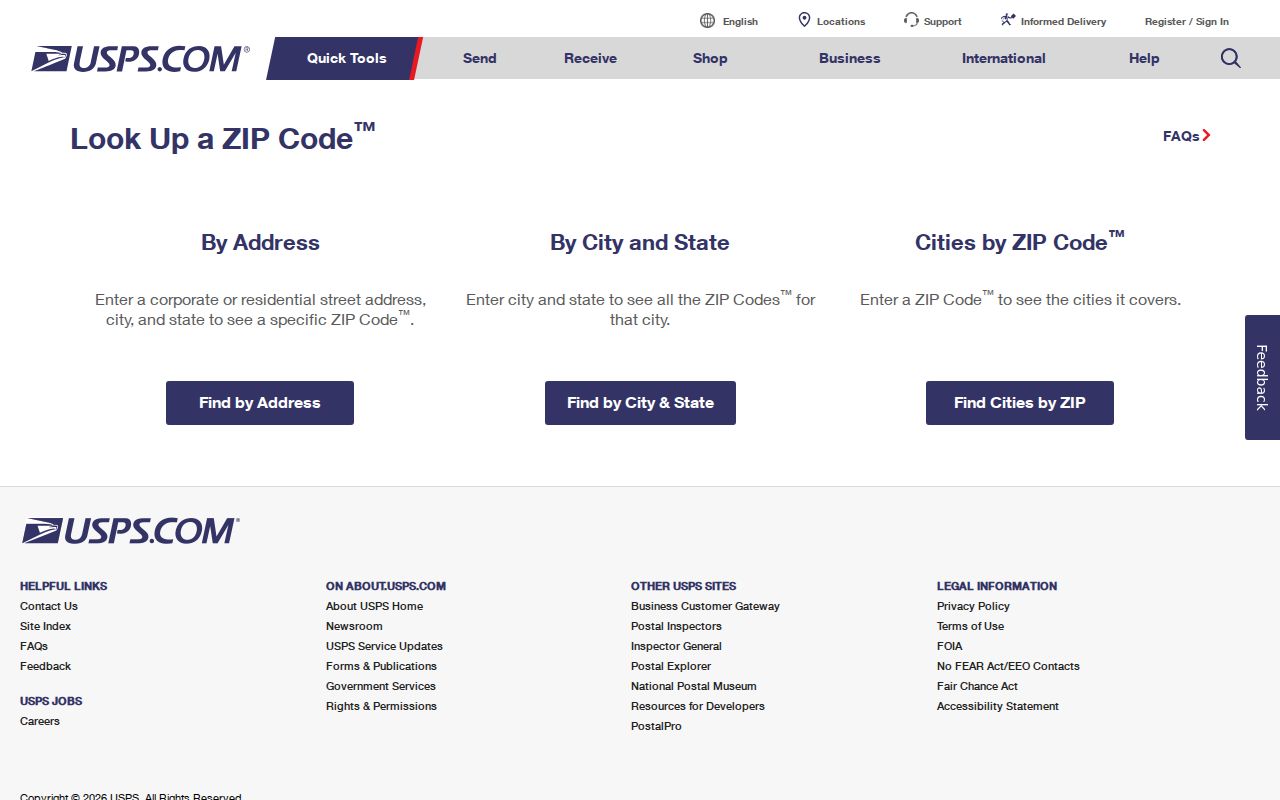
The three modes answer different questions, so a city-wide result should always be followed by exact-address validation.
Dalton 30720 Postal Area
ZIP code 30720 anchors west and central Dalton and a broader western Whitfield postal area. The main Dalton Post Office at 100 S. Thornton Avenue uses 30720-9998. It supports normal street delivery as well as boxes. Its reach beyond the incorporated line is the crucial limit: a 30720 address may use Dalton as the postal city without being a City of Dalton parcel.
For resident research, verify the exact mailing line in USPS, then search the physical address in Whitfield qPublic. Read the parcel's tax district and situs location. Do not substitute the owner's 30720 mailing address for the parcel's own code. One owner can receive tax mail in 30720 for a parcel whose situs is in 30721.
Dalton 30721 Postal Area
ZIP code 30721 centers on east Dalton and the eastern Whitfield postal area. USPS lists the East Side facility at 1119 E. Morris Street as 30721-9998. This station is a clear postal anchor, but it does not turn the code into a city-limit outline. County territory can carry the same Dalton postal label.
qPublic's documented main search fields are owner name, location address, and parcel number. A complete ZIP-wide owner filter was not confirmed. Search a situs address or browse mapped parcels instead of assuming a portal can produce every 30721 resident. The distinction keeps the ZIP code directory focused on postal geography and hands detailed street work to the Dalton street directory.
Why Dalton 30722 Is Different
ZIP code 30722 is PO-box routing, not a residential neighborhood. It cannot be shaded as a home area or used to infer where someone lives. A 30722 line says that mail goes to a box in the Dalton postal operation. It does not place the recipient's house, parcel, business site, or government office inside one geographic zone.
Dalton City mail illustrates the rule. The City's P.O. Box 1205 uses 30722, while the physical City Hall address is 300 W. Waugh Street. Those are two distinct address facts. Search the physical location when a parcel or jurisdiction matters. This PO-box quirk is why every Dalton ZIP code directory needs a separate row for 30722 rather than treating all three codes alike.
Key distinction. A post-office box identifies a mail receptacle, not a residence, parcel, neighborhood, or incorporated-city location.
Find Dalton Residents by ZIP
A ZIP code narrows a search, but the local property portal does not document a full ZIP filter. Work from a verified address or mapped area. USPS confirms the delivery code; qPublic connects a location to a parcel and owner; GIS shows whether the parcel lies within Dalton. The ordered Georgia voter-list channel may offer geographic products, but My Voter Page is only an authenticated individual lookup and must not be used as a ZIP browser.
- Confirm the code and ZIP+4 for the exact address with USPS.
- Search the situs address in Whitfield qPublic.
- Preserve parcel number, Realkey, owner mailing, and situs as separate fields.
- Open Whitfield GIS to check the city line and tax district.
- Use only a lawful ordered voter product for broader voter geography.
This workflow can identify owners and public registrations, but neither source proves every occupant. Renters, minors, nonvoters, protected voters, and other household members can be absent. A ZIP code search is a way to organize evidence, not a full roll of all residents.
Dalton Postal and City Limits
Postal Service routing and municipal government answer different questions. USPS assigns a delivery code and postal city label. Dalton and Whitfield County maintain local address, planning, tax, emergency-service, and parcel facts. An annexation can change city services or tax jurisdiction without changing a ZIP. A property can also retain a Dalton mailing label while never entering the city.
The City Clerk maintains annexation records and municipal documents beginning in 1884. If a city-limit question matters, compare the parcel map, tax district, and annexation file. Do not draw a boundary from a few addresses. No official ZIP layer in the Whitfield viewer was confirmed in the research, so directional descriptions remain deliberately broad.
Note: Census totals, county population, postal coverage, and incorporated Dalton each describe a different geographic universe and should never be combined.
Read Dalton Address Types Correctly
Several address forms can appear in one resident search. The situs or physical address locates the parcel. The owner mailing address tells the tax office where to send correspondence. USPS delivery data validates mail routing. A legal description ties title to land through acres, subdivision, block, lot, or deed references. Whitfield parcel numbers use a hyphenated format such as 12-078-01-000, and the Realkey is a second internal identifier.
- ZIP versus ZIP+4
- A five-digit routing area versus a more specific delivery segment.
- PO-box ZIP
- A code assigned to box mail rather than a residential land area.
- Unique ZIP
- A code assigned to one high-volume organization; none was confirmed for Dalton.
- Carrier route
- A postal delivery path that does not serve as a city boundary.
- Situs address
- The standardized physical location used on the parcel record.
Keep each field under its source label. Calling an owner-mailing line the property address can move a person or parcel to the wrong side of Dalton. Calling a legal description a street address loses the stable land identity needed after a road name or number changes.
Resolve Old Dalton ZIP Addresses
When an older address fails, check spelling, directional prefixes, and street type with local addressing staff or GIS, then retry USPS. Historical directories may use an earlier street number or a scope that reached beyond the city. Compare the directory street guide with Sanborn sheets from 1885, 1914, or 1941. Match the building footprint, cross streets, lot shape, and legal description before claiming continuity.
Search deeds by party and legal description if a modern street number does not appear. City Clerk annexation minutes can explain a jurisdiction change. GIS staff may know road aliases or parcel history. No single official Dalton renumbering event was found, so a date must not be invented. State the actual bridge evidence, such as matching lot, block, and cross streets.
Dalton Post Office Details
The main and East Side offices provide tangible anchors for the two street-delivery codes. Use the USPS Dalton location listing to confirm live retail details before a visit. Postal hours and services can change, and the location page is more reliable than a copied directory entry.
USPS shows the Dalton facilities on the captured listing.
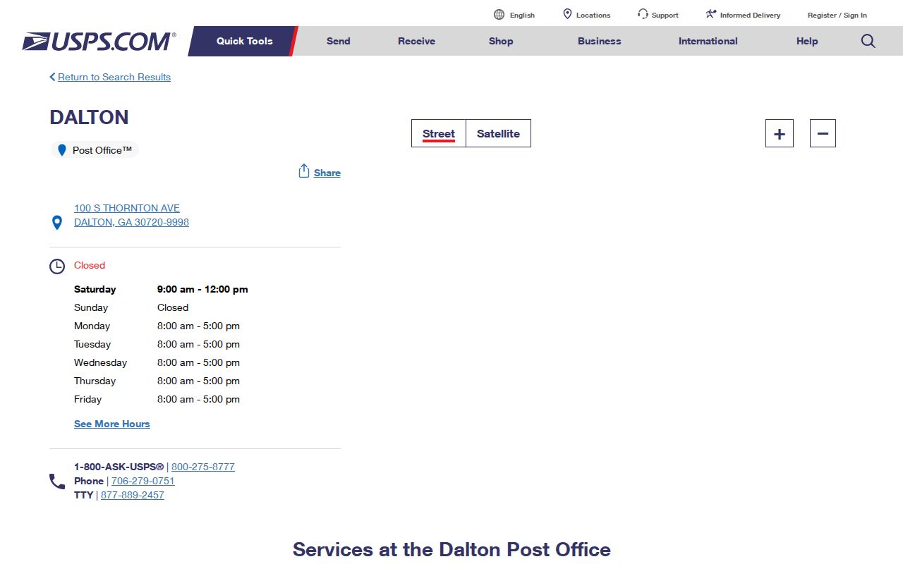
The listing supports the west and east postal anchors, while exact addresses still need their own lookup.
Limits of a Dalton ZIP Directory
A Dalton ZIP code directory cannot establish residence, ownership, legal jurisdiction, or every person at an address. It cannot turn a PO box into a map point. It also cannot prove that a parcel lies in the city merely because its mailing city says Dalton. USPS, qPublic, GIS, deeds, and annexation files each control a different fact.
Use public records for lawful personal research and keep protected details out of any shared list. VoteSafe addresses and other confidential data stay hidden. Date each lookup because postal assignments, parcel ownership, and city limits can change. When sources disagree, retain both results and ask the office responsible for the disputed field.