
Walk a Dalton Street by Address
A sound Dalton street directory search moves from the parcel to the people evidence. The assessor establishes a current ownership record and a stable parcel number. The GIS map then shows the lots beside it. Deeds explain transfers, while voter lists and old street listings can add dated signs of residency. None of those sources alone proves every person who lives at a home.
- Enter the location in the Whitfield qPublic property search. Save the parcel number, situs address, owner name, mailing address, and legal description.
- Open the Whitfield County parcel viewer. Pan along the same street and inspect each adjoining parcel.
- Use the legal description and owner name in the deed index. Confirm each match by land description, not merely by surname.
- For registered-resident evidence, use a lawfully ordered Georgia voter list. My Voter Page is an authenticated personal lookup, not a public street browser.
- For an earlier household, check the Dalton library's directories, street sections, census sources, and map holdings.
This sequence makes the street-by-street work repeatable. Keep a row for each parcel, and note the source date. A street directory is strongest when every name is tied to a record, a date, and the correct lot.
Search Dalton Streets in qPublic
The Whitfield County Board of Assessors supplies the main search by address. A broad street-name query may return several parcels, depending on how the current interface handles the text. Start with the street name, then narrow by number. The result card separates owner correspondence from the land's physical address, which is vital to any Dalton street directory.
| Search control | Input | Required | Use by street |
|---|---|---|---|
| Owner Name | Text | No | Test a known surname or organization |
| Location Address | Text | No | Enter a house number and street, or try the street alone |
| Parcel Number | Text | No | Return to one confirmed parcel |
| Search / Reset | Buttons | No | Submit or clear the criteria |
A parcel card may show a Realkey as well as the formatted parcel number. Preserve both when asking staff about a legacy record. It may also show acreage, tax district, neighborhood, map number, subdivision, block, lot, value fields, and links to a property card or GIS map. Those details distinguish similar addresses.
Note: The assessor values property; the Tax Commissioner collects tax, so a payment record is not an occupant roll.
Dalton Street Directory Address Terms
Three address ideas appear in Whitfield records. Mixing them can put a person on the wrong Dalton street. The parcel number and legal description are more stable than postal wording, especially when a street name, number, or city boundary changes.
- Parcel
- A mapped unit of land with its own county identifier.
- Situs address
- The physical location assigned to the parcel.
- Plat
- A recorded map that lays out subdivision lots, blocks, and boundaries.
- Criss-cross directory
- A directory arranged by street and house number rather than only by surname.
The owner address receives tax mail. It may be in another city or state. That signals an owner who receives mail elsewhere, not the identity of a Dalton occupant. A homestead exemption may support owner occupancy when it appears on a current card, but it still does not name the whole household.
Dalton Records Indexed by Street
Address sources overlap, but their limits differ. The best Dalton street directory uses each record for what it can establish, then records the gaps without guessing.
| Address source | Custodian | What it contributes | Access route |
|---|---|---|---|
| Property roll | Whitfield Board of Assessors | Owner, mailing and situs addresses, parcel and legal description | qPublic; assessor counter |
| GIS | Whitfield County GIS | Parcel shapes, adjoining lots, maps and plat links | Online viewer; GIS staff |
| Recorded deeds | Clerk of Superior Court / GSCCCA | Grantors, grantees, dates, book/page and land description | Online index; courthouse books and certified copies |
| Voter lists | Georgia Secretary of State / elections officials | Registered names and addresses, with protected records withheld | Ordered public-list product |
| Permits and code files | Dalton / Whitfield inspection offices | Site, applicant, contractor, work type and dated events | Targeted office request |
| Historic directories | Dalton library / DLG | Printed occupants, names, and street context for a publication year | Digitized volumes and library help |
The parcel identifier ties assessment and map evidence together. The deed's legal description carries the trail into older books. A street name connects printed and request-based sources, but the match still needs a date and number.
Move Along Dalton Parcels
The legacy Whitfield GIS gateway offers a general parcel search, parcel-number search, comparative sales, scanned subdivision plats, and a map. Popups must be enabled for parcel detail. The newer Esri viewer supports map search, zoom, pan, and feature popups, though its exact layers can change.
Click one parcel at a time along the segment. Record the situs, parcel number, owner, and any assessment-detail link. GIS geometry is useful context, not a legal survey. A plat or deed controls when map lines and written land descriptions differ.
The free viewer is the quickest route. If a popup fails or a historical layer is absent, call GIS or visit the assessor with the parcel number. Online map limits do not end the street search.
Turn Dalton Addresses Into Deeds
Ownership history sits with the Whitfield County Clerk of Superior Court and the GSCCCA real-estate index. Search the current owner as grantee, open the acquisition reference, note the grantor, and repeat backward. Available controls include county, instrument type, party role, last or organization name, first name, middle name or initial, date span, and book/page or instrument number.
The exact starting year for Whitfield's online deed index is not published in the available official material. Older books, restricted images, certified copies, and items missed online require the courthouse counter at 205 N. Selvidge Street. Index use may be free while images, certification, or subscriptions can cost money. Confirm the current terms before ordering.
The Georgia deed-index screen shows the statewide path used to move from a parcel owner into grantor and grantee records.
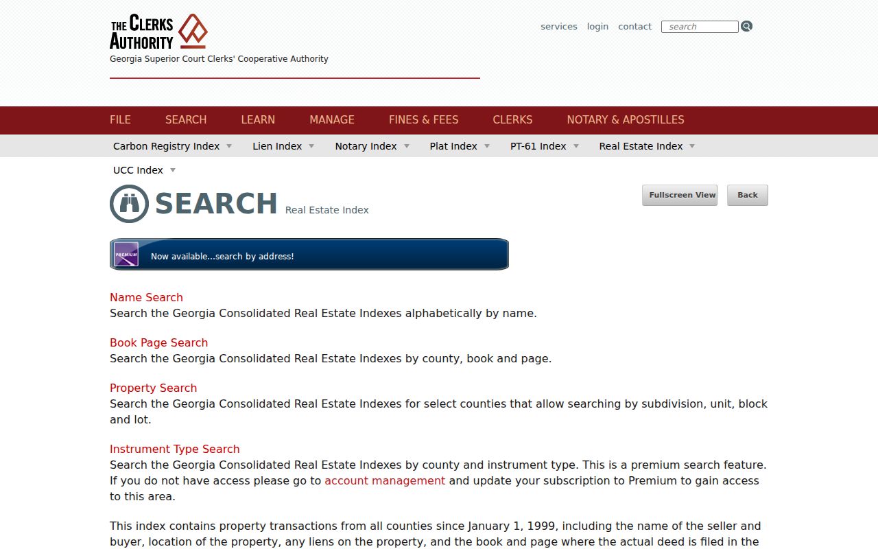
Use its party and date controls as finding aids. A recorded deed proves a title event, not that the named party lived at the address.
Historic Dalton Streets and Maps
The Dalton street directory reaches beyond current parcels through selected digitized directories from 1940 through 1963. Street-order or reverse material, where present, can place a printed name at a numbered address. Full collection detail belongs in the Dalton city directory, while the address researcher should preserve the printed wording and publication year.
Sanborn fire-insurance maps add building footprints, uses, street layout, and historic numbering. Verified Dalton points include January 1885, UGA holdings through 1914, and a 1941 Library of Congress set with 23 sheets. They do not name residents by themselves.
The UGA Dalton Sanborn holdings page identifies the map years available through its collection.
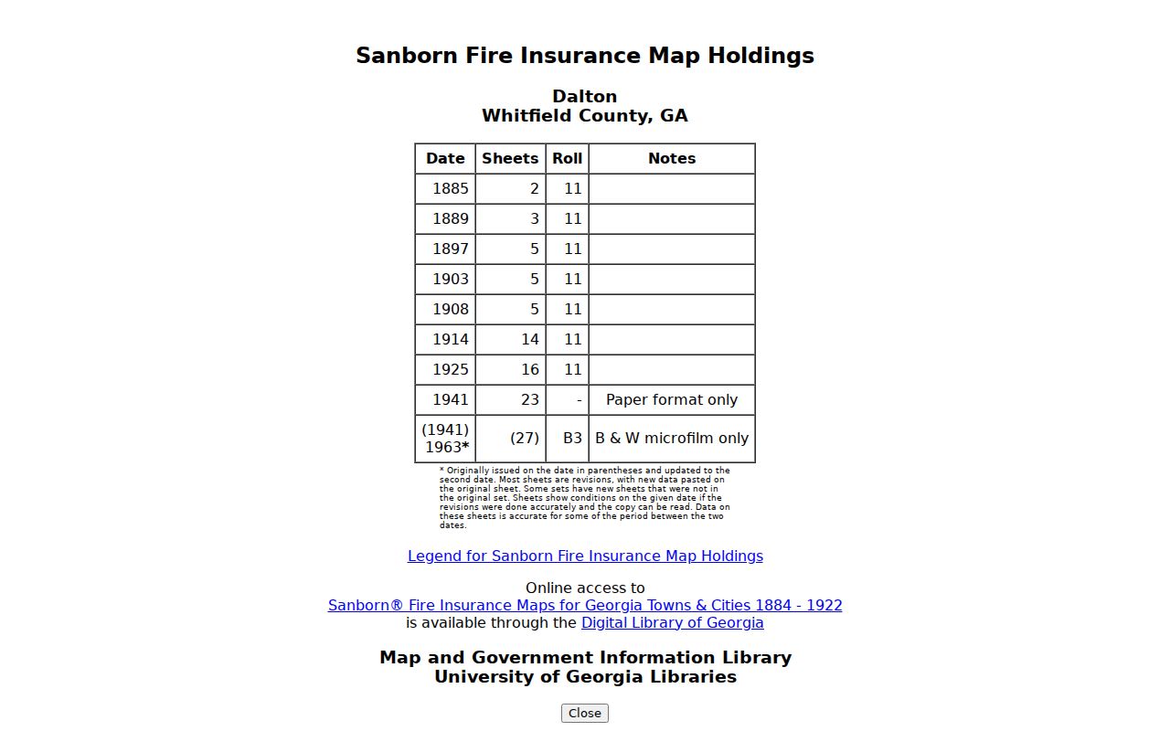
Match a directory address to the sheet index, then compare the block with a plat and deed description before claiming continuity.
Postal Dalton Versus City Streets
A DALTON mailing line does not prove that a parcel lies within Dalton city limits. USPS ZIP geography serves delivery, while municipal limits determine city jurisdiction. Whitfield GIS, parcel tax district, annexation material, and the City's official records provide stronger evidence than the postal city alone.
No authoritative, citywide Dalton street-renumbering year was found. When old and new numbers conflict, compare directory street sections, Sanborn sheet indexes, subdivision plats, and deed legal descriptions. Mark the suspected change. Do not force two addresses into one story.
For a permit or code file, give the street address, parcel number, date range, and category. Dalton-Whitfield Building Inspection and county engineering share development work, and county Engineering has handled land-disturbance and stormwater permits inside Dalton since 2015.
Dalton Street Voter Evidence
Georgia makes voter names and addresses available through ordered voter-list products. That route is separate from My Voter Page, which asks for a first initial, last name, county, and date of birth to return one voter's registration and district information. It is not designed to browse everyone on a street.
A list can show registered voters at an address, but not every adult or any ballot choice. Renters may appear where an assessor owner does not. Several voters may share one home. VoteSafe withholds qualifying protected addresses. Keep the voter date, source, and status beside each street-directory entry.
Note: Use the public list-order channel for street research; never try to turn the authenticated personal portal into a bulk search.
Request Dalton Street Records Offline
Online search is only one access channel. The Board of Assessors can explain a parcel card at its office at 201 S. Hamilton Street, third floor, in Dalton. Its listed phone is 706-275-7410, and its weekday hours are 8 a.m. to 5 p.m. Bring the parcel number as well as the street address. The Clerk of Superior Court counter is the fallback for older deed books, plats, certified copies, restricted images, and instruments that do not appear in the online index.
Municipal address evidence may require a focused written request. Dalton's City Clerk keeps minutes and official documents from 1884 forward, including annexation records. The updated City request form accepts inspection or copy requests by email at openrecords@daltonga.gov or by mail to City of Dalton Administration, Attn. Open Records Officer, P.O. Box 1205, Dalton, GA 30722. Describe the record series, exact address, date range, and preferred format. The three-business-day rule covers a response or timetable, not guaranteed production in three days.
When permit or inspection evidence is needed, include the site, permit number if known, and type of work. For old address material, the Dalton-Whitfield County Library and Georgia Archives fill gaps left by current portals. Ask the library about street or reverse directories, maps, phone books, newspapers, and yearbooks. Ask the Archives about a specific Whitfield microfilm series shown in its county-card catalog. A precise request is more useful than asking an office for every record about a street.
Protect Dalton Address Research
Address research can help confirm a seller, understand a family property, or document how a block changed. Protect the notes as carefully as the source. Do not publish sensitive details about children, protected voters, or people who are not part of the research purpose.
The Georgia identity-theft guidance explains how personal details can be misused.
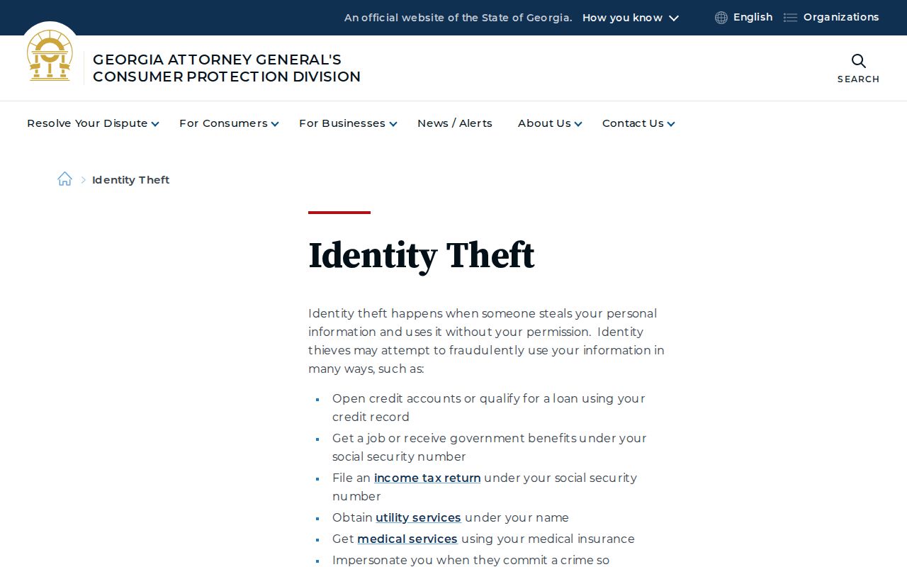
That risk is why a by-address table should contain only the facts needed for a lawful, personal task.
Limits of a Dalton Street Directory
No public source supplies a complete, live household list. Assessor records omit renters and household members. GIS shows geography, not people. Deeds show title events. Voter lists omit people who are unregistered, ineligible, or protected. Historic directories reflect the publisher's coverage and can contain print or OCR errors.
Utility customer data and driver records are not substitute street rolls. When a name appears, verify it against a second independent source and preserve the dates. When no public evidence exists, leave the Dalton address unresolved.
Lawful use. Use Dalton street records for a legitimate personal purpose. Never use address information to stalk, harass, threaten, or harm anyone.